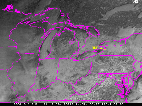
 The corresponding visible image (top right) also shows these water cloud areas.
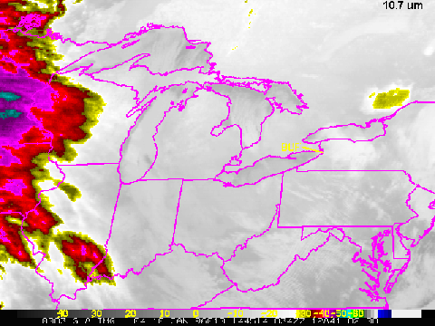
An estimate of cloud top temperature from the corresponding 10.7um image
(right) determined that for the clouds around Buffalo, typical cloud top
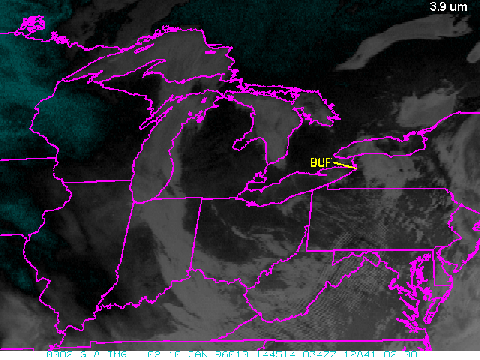
temperatures were about -24 C, which, along with the 3.9 um data, indicates a
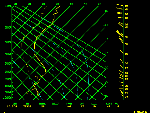
supercooled cloud. The 1200 UTC sounding from BUF
on the 10th shows cloud top temperatures to be around -20 C, an important
verification. (This is especially true if additional cloud layers exist above the
suspected supercooled water cloud, since they would affect the 10.7 um
brightness temperatures.)
The corresponding visible image (top right) also shows these water cloud areas.
An estimate of cloud top temperature from the corresponding 10.7um image
(right) determined that for the clouds around Buffalo, typical cloud top
temperatures were about -24 C, which, along with the 3.9 um data, indicates a
supercooled cloud. The 1200 UTC sounding from BUF
on the 10th shows cloud top temperatures to be around -20 C, an important
verification. (This is especially true if additional cloud layers exist above the
suspected supercooled water cloud, since they would affect the 10.7 um
brightness temperatures.)