CLOUD STREETS - SHORT SUMMARY
by KNMI
Example
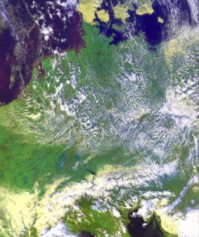
Example of cloud streets (DLR, RGB124)
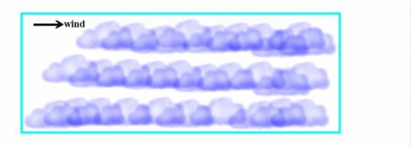
Typical cloud configurations
- Organised lines of convective clouds (cumuli), quite often in an otherwise lightly cloudy area (over land or sea). The appearance is white in VIS-, grey in IR- and yellowish white to white in RGB124-image
- Downwind the cumuli grow and sometimes reach the shower stage:
White parallel lines downwind disturbed by white bulges in the satellite images (IR, VIS and RGB124)
Weather Events
Relevant numerical parameters and their typical distribution
- Surface wind speed
- Wind direction in boundary layer
- Temperature inversion height
- Humidity in boundary layer
- Stability in boundary layer
Physical Background
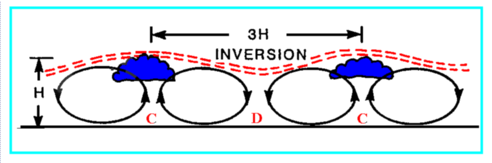
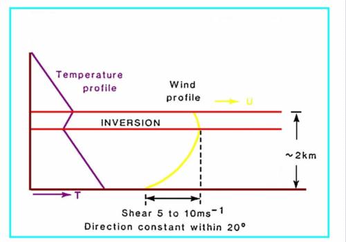
The physical processes are shown in schematic 1, the physical conditions are seen in schematic 2.- Presence of an temperature-inversion at height (H)
- Convergence (C) at surface: rising air parcels;
- Divergence (D): descending air.
- Condensation just beneath inversion height
- Wind profile in boundary layer as boundary condition
|
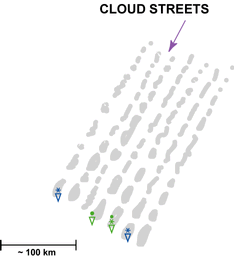
A typical cross section perpendicular on the cloud streets
|
A typical temperature and wind velocity profile
|
|
|