
Tropical Cyclone Research Future Satellite Studies
Synthetic GOESR-ABI 10.35 µm imagery has been re-created from an updated simulation of hurricane Lili. Synthetic images were created every fifteen minutes with a horizontal footprint of 2 km over a 12 hour period. These images will be treated as observations and will be used in an assimilation experiment of hurricane Lili. (L. Grasso and D. Zupanski).
Simulated three dimensional fields of u, v, w, t and water vapor at a given time from hurricane Lili were saved from the grid with 2 km horizontal grid spacings. These grid spacings approximate the footprint of GOES-R ABI. This output will then be degraded to larger footprint sizes to test pressure retrieval algorithms. (L. Grasso and M. DeMaria).
A collection of full resolution (temporal, spectral, and spatial) Meteosat Second Generation data was collected over the tropical Atlantic 1 June 3 December for future satellite applications. These are being written to DVD for future use.
An automated collection of 1 km, Mercator, IR imagery over Global tropical cyclones begun last quarter has been expanded to collect IR imagery at 1 km, 2 km, and 4 km resolution as well as visible imagery at 1 km and 0.5 km (MODIS only). At present NOAA Limited Area Coverage (LAC) and High Resolution Picture Transmission (HRPT), and NASA Moderate Resolution Infrared Spectroradiomenter (MODIS) data are accessed and utilized. This imagery will be utilized to study the effects of increased resolution on tropical cyclone intensity and structure algorithms. (J. Knaff)
Figure 1a
Click on images to enlarge
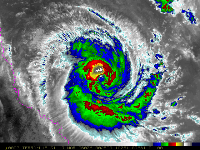
Figure 1b
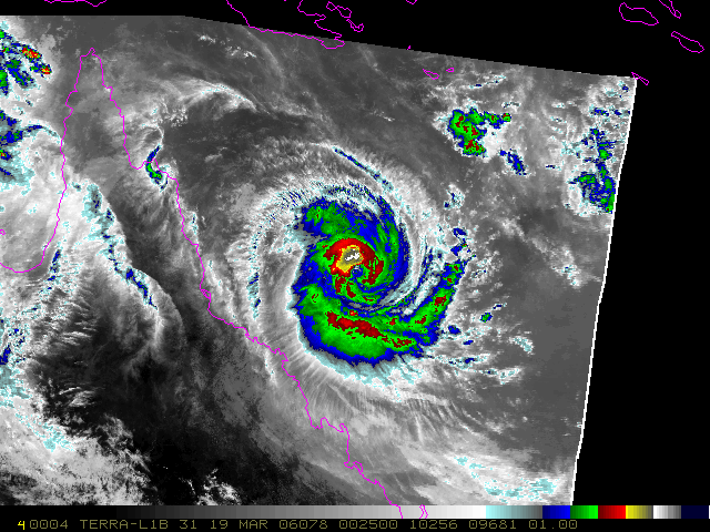
Figure 1c
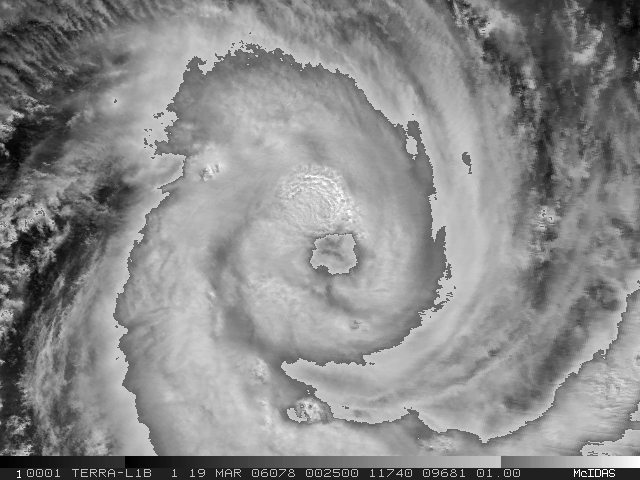
Figure 1d
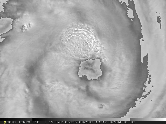
Figure 1e
Figure 1a-e: Example of 1-km, 2-km and 4-km IR imagery and 1 km and 500 km visible imagery collected over Tropical Cyclone Larry on 19 March at 0250 UTC. This imagery that is being collected for future risk reduction activities. Tropical cyclone SH1706 on 19 March 2006 at 0600 UTC had an intensity of 75 kt and was rapidly intensifying.
Collection and analysis continues with 1-km resolution IR images of hurricanes from AVHRR and MODIS. Previous studies have been summarized and future studies planned on the impact of resolution on satellite intensity analysis. An abstract for a poster presentation with Mark DeMaria and John Beven (Tropical Prediction Center) was submitted to the upcoming GOES-R User's Conference, Broomfield, CO, May 1-3, 2006. (R. Zehr)
![]()
Return to the current RAMM Branch Quarterly Report
RAMMB/CIRA Quarterly Report January February March
2nd Quarter FY06