Hillger, Campbell, Combs, Dostalek
![]()
A new 4PANEL program for McIDAS
was developed to take any 4 image channels and generate an AREA that displays
all 4 channels in quadrants with earth-location maps. The program
works on either 1-byte or 2-byte data, thus generating a display without
any loss of data precision when used in 2-byte mode. The 4PANEL program
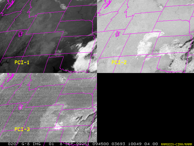
is being used to display up to 4 Principal Component images on one frame
on the new SAB RAMSDIS to look for volcanic ash, fires, and snow/ice detection
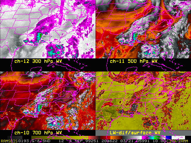
by concentrating on GOES channels 2, 4, and 5. The program can also
be used to display any 4 GOES Sounder channels in a 4-panel display and
is being used on the Sounder RAMSDIS to display multi-level water vapor
imagery. Development of 4PANEL was necessary because the standard
McIDAS version of PANEL does not work on RAMSDIS units.
 |
 |
Progress has been made on a paper entitled "GOES Derived Product Imagery: Statistical Comparison to Radiosonde Observations and Use in Forecasting Severe Convection along a Dryline" in preparation for its submission to Weather and Forecasting.
The GOES Autoestimator rainfall estimation product was added to RAMSDIS systems in the CIRA computer lab. This product was added in preparation for upcoming GOES Assessment Activities.